The Suncoast Will Feel the Effects of Subtropical Storm Nicole Wednesday and Thursday
Subtropical Storm Nicole will bring wind and rain to the Suncoast this week.
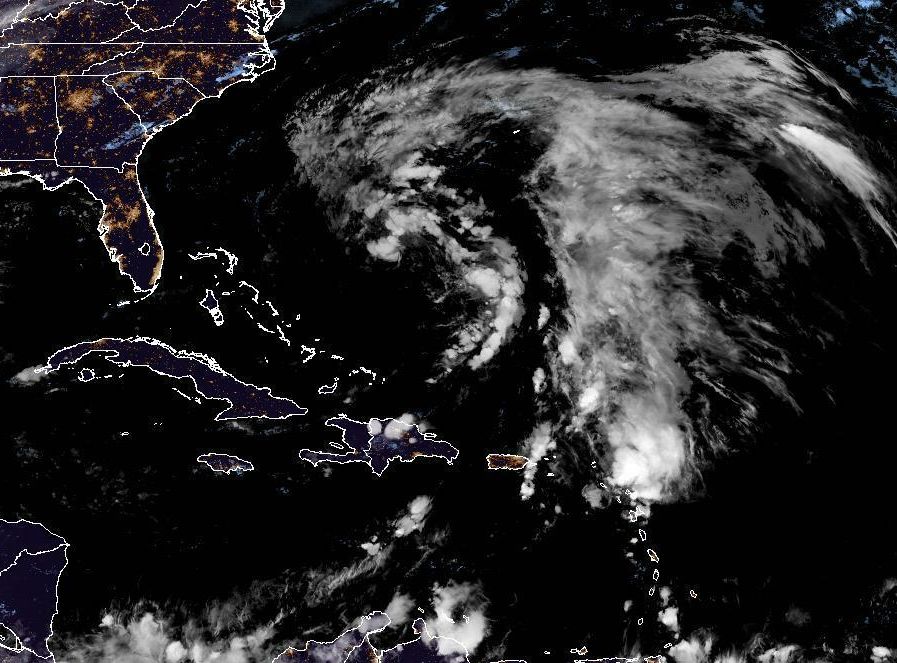
Image: NOAA
Subtropical Storm Nicole is getting organized in the Atlantic and hurricane warnings are flying in the northwest Bahamas. A hurricane watch and storm surge watch are in effect for portions of southeast Florida, as well.
Nicole is very large, with gales now raking outward into the Atlantic some 300 miles northeast of its center. Because the storm is huge, it will take some time for it organize as it slowly moves toward the Bahamas and then Florida's southeast coast.
As I wrote yesterday, the most important factor is how much the storm can strengthen as it approaches Florida. Warm sea temperatures and low wind shear mean Nicole will have favorable conditions in which to strengthen—especially starting tomorrow afternoon, as its circulation becomes more established. Rapid strengthening has been the new normal in storms in recent years, and I am on the lookout for signs it could happen again.
Probabilities are increasing that a Category 1 hurricane will make a landfall Wednesday night on the southeast Florida coast.
The Suncoast will face tropical storm conditions beginning Wednesday night and continuing though a good portion of Thursday. Should the storm become a Category 2 before landfall, higher winds will be possible here. Because Nicole is so large, strong gales are expected regardless of the exact path of the storm. Heavy rains will occur and I'm most worried about the possibility of coastal flooding along the barrier islands and bayfronts from Venice to Tampa Bay.
Believe it or not, from Sept. 2 though today, eight storms have formed—and should Nicole become a hurricane, all eight of them will have been hurricanes. This is life in a climate-warmed world.
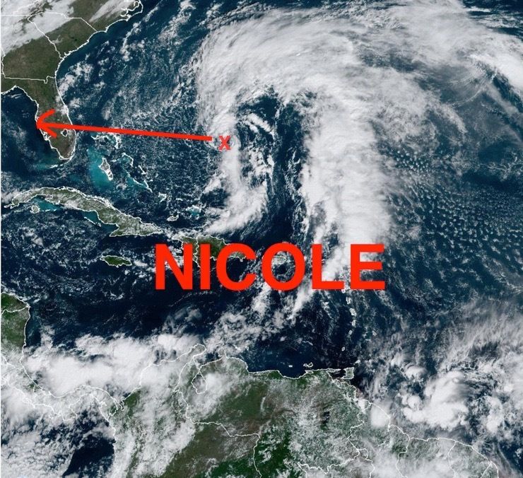
Subtropical Storm Nicole
The NOAA satellite image above is loaded with insights about this storm. Comparing the the image I shared with all of you yesterday, notice how the center is taking shape. Next, the storm will start to build thunderstorms around its center and become better organized. The path shown is a general vector of expected movement—but therein lies the threat for the Suncoast.
Other points to consider:
The center is forecast to pass just north of Sarasota Wednesday. The winds will therefore be onshore—the opposite of what occurred with Hurricane Ian.
A full moon will occur tomorrow and full moons mean higher tides even without storms.
High tides this time of year are the highest of the year! High tide Thursday is just after noon.
Given these points, we need to be prepared for very high tides, some storm surge with onshore winds if the center does pass just north of Sarasota and enhanced flooding due to the storm passing close to the time of high tide and a full moon.
Now is a good time to...
- Consider if you are in a low-lying area and could face high tides and storm surge;
- Figure out where you will go if you need to evacuate;
- Stock up on water, batteries and essentials now while you have time; and
- Get prepared and watch what is going on in the tropics
And remember:
- Sea levels are already 9 inches higher than they were 50 years ago, so minor storms have bigger flooding impacts.
- Escape routes can be very vulnerable because roads in many areas have not been raised.
- Power can be off for days in some areas depending on the severity of winds and surge. Consider this in your planning.
Bob Bunting is a scientist, entrepreneur and educator and the CEO of the nation’s first Climate Adaptation Center (CAC), headquartered in Sarasota. The Climate Adaptation Center is an expert resource to inform government, academe and the private sector so they can create the necessary adaptation strategies and actions to protect the Florida way of life and foster the climate economy as well as larger global solutions evolve to solve the climate problem. For more information, visit theclimateadaptationcenter.org.


