A Walk on the Beach
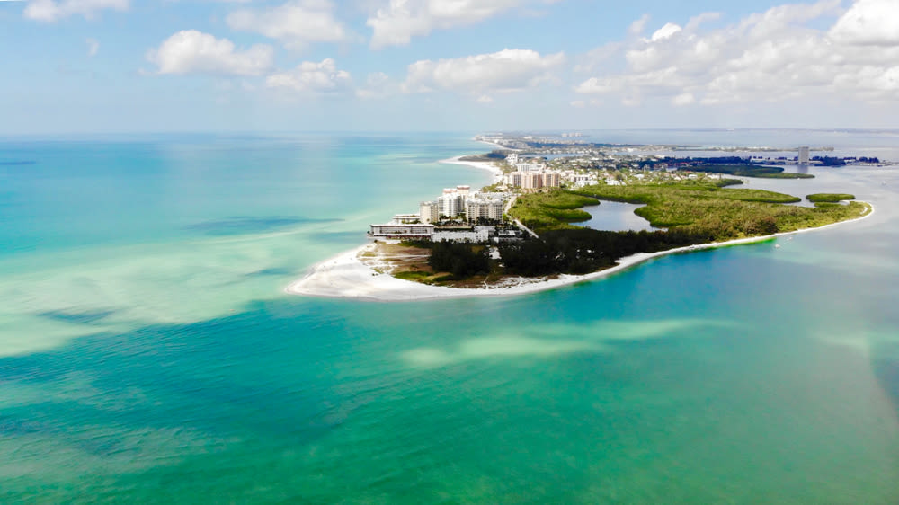
Image: Shutterstock
My beach-going days began early, when my mother took me on my first visit to the Gulf shore when I was just a few days old. I don’t remember that trip—although maybe the rhythm of the waves and the fresh breezes helped to soothe me to sleep—but I do remember exploring just about every nook and cranny of Fort Myers Beach, whether in sunshine or thunderous tropical downpours, during my childhood.
My first date with my wife, Michelle, was a walk down TurtleBeach here in Sarasota, and we spent several summers house-sitting on Manasota Key. At that time, we were working with sea turtles, so we got to know the beach by day and night. But in recent years, all the distractions of busy adult lives have kept us from spending much time along Sarasota’s shoreline. And that’s ironic, since as general manager of Sarasota’s Parks and Recreation Department, I oversee all of our county’s public beaches.
This summer I decided I needed to get back in touch with Sarasota’s beaches, our greatest natural resource and public playground and the magnet that drew so many of us here. I announced to Michelle that I was going to take a week’s vacation to walk every one of Sarasota’s 35 miles of shoreline. She looked at me and replied, “I’m going with you!” So during a steamy week in late August, we spent our evenings making plans for our grand expedition.
We decided that each day we would explore one of Sarasota’s six barrier islands, looking to see how time had altered them since we had last visited. We drew up a map of the county’s beaches and estimated the length of each day’s walk, noting where we had convenient access and where we would encounter obstacles, both manmade and natural. The primary natural obstacles were the magnificent passes, the gateways from the Gulf to the bays. During our journey we would encounter three deep-water passes—New Pass, BigSarasotaPass and Venice Inlet. These passes add a tremendous dynamic to the ends or “points” of each island, constantly shifting the sand and changing the look and feel of the nearby beaches.
We decided to start on the north end of Longboat Key and work our way south each day. We would use public transit for some islands and shuffle two cars around to accommodate one-way hikes on the longest stretches. If we covered one island per day, we would finish the week, and our adventure, on Manasota Key near Englewood. While the length of our proposed walk was not a tremendous challenge, the soft beach sand, scorching summer sun and unknown obstacles were sure to slow us down and challenge our commitment. Our confidence landed somewhere between thinking we could do it and wondering if we could.
To document our discoveries, Michelle brought a camera, and I brought a notepad. We brought small sacks for collecting shells—perhaps we would find a few worth keeping. Since we were walking in the middle of the summer, protection from the sun and heat was essential. We wore long-sleeved shirts, hats and plenty of sunscreen. We froze two water bottles each night to have cool water for the next day’s walk, and we brought along an extra bottle as a safety measure. We packed cereal bars and apples for snacks, and a first-aid kit for insurance. With much of our walk conducted miles from public facilities, it was important for us to be safe and prepared for the journey. While we made our final plans, Tropical Storm Gustav pushed past us in the Gulf.
We began our journey on what we believed to be our most challenging beach, the shoreline of Longboat Key. It was a long walk for our first day, and access would be tricky on this upscale island, where gated condominiums and private property adjoin most of the beach. Because of the desirability of Longboat Key real estate, we expected to see nothing but condominiums marching along the shoreline. And since the beach is regularly re-nourished, we expected a monotonous and sterile shoreline.
We wanted to get an early start and make the most of our first day on the beach. So at 7 a.m., we were loading up our gear, and by 8, we were parking on St. Armands Key. We took the trolley all the way north and asked the driver to let us out at a little spot where we could slip out onto the beach. The busy world was behind us, and 35 miles of beach adventure lay ahead.
We stepped off the sidewalk and into the dunes, using the time-delay setting on Michelle’s camera to take a photo of us together at the edge of the beach. Our adventure had begun!
As we walked down to the water’s edge, cool breezes swept over us. The sun had been up for about an hour, and the light illuminated the unusually clear blue-green water. Perfectly cylindrical waves rolled in one after another, cast off by the passing storm. We were drawn to a tremendous pile of storm-tossed shells and stooped down to collect some favorite specimens—shiny olives, ornate murex and graceful lightning whelks. Large cat-eyes and a rainbow of scallops reminded me of my childhood shell collection. It felt like a treasure chest of beach gold had burst open on the sand. We looked up at the clear sky, out at the Caribbean-hued water and down at our marine treasures. We had started our journey at the perfect beach!
While the treasure pile of shells could have held us there for an hour, we reminded ourselves of our mission, and began trudging towards the south. As we looked around, we began to see another surprising feature of Longboat Key: the emergent dunes. These dunes were planted with native shoreline species to enhance the beach ecology and stabilize shifting sands. They offered a welcome contrast to the expected flat shoreline. We spotted a wide variety of shorebirds, sandpipers and plovers and birds we did not know the names of. The beach was quite clean, with virtually no trash. An interesting natural wrack-line was being surveyed by the birds for a meal and by us for marine treasures. Hundreds of bright purple sea-urchins tossed up by the storm were scattered all along the shoreline. The beach that we expected to be flat, sterile and boring was actually filled with contour, life and discoveries.
There is so much to see on the beach, both natural and manmade, and we were trying to take it all in. After we passed low-rise homes, resorts and apartments, larger condominium towers began to emerge in the distance. One was further seaward than the rest, casting an early morning shadow across the upper portion of the beach. We rested here for a few moments in the welcome shade. The sun was rising, and the cool beach morning would soon be giving way to a sweltering day.
Later we discovered an old abandoned beachfront house complete with ornate ironwork and stained glass windows. We daydreamed about winning the lottery and restoring this once proud estate.
We walked a little higher on the beach and admired all the tiny shade structures that have been built over the years. Many of these shade huts are just a center pole topped with a simple round roof of sabal palm thatch. At a busier time of year, these little huts would be the personal beach canopies for winter residents and tourists. Today they were mostly vacant, although one was occupied by a handsome great blue heron taking a shady beachfront nap.
As we approached the south end of the beach, I told Michelle about John Ringling’s old coconut palm plantation and his efforts to bring a Ritz- Carlton Hotel to Longboat Key during the 1920s. The hotel was never finished, and the abandoned structure overlooking NewPass became both a landmark and a curiosity. The “ghost hotel” was eventually razed, and Ringling’s vision of a Ritz-Carlton Hotel for Sarasota was finally realized—although on the nearby mainland—75 years later.
Several hours after our journey began, we reached the southern tip of Longboat, and we looked out upon NewPass. Longboat Key was named for the auxiliary “ship’s boat” that would allow the Spanish explorers to investigate the shallow passes and bays while their seagoing vessels were anchored safely offshore. Decades ago, a storm uncovered an ancient longboat on this beach, lending credence to the island’s name. We agreed that the island that welcomed maritime explorers 500 years ago was still offering up new discoveries today.
Our next beach to explore was Lido, a place that is very familiar to us and yet one that changes constantly with the tides. We walked a trail through the expansive dunes and emerged out on the beach near the island’s northern tip. Here we found the striking evidence of the changing nature of the barrier islands. Tree roots emerged from the water like skeletons of an old forest. Large dunes had been carved by the waves, leaving vertical cliffs of sand. The entire area had changed dramatically since my last visit, and the waves were changing the shoreline as we walked. As dry sand collapsed down the faces of the newly carved dunes, we were reminded of a sand-filled hourglass, with sands that are constantly shifting over time.
While Lido Key is more urban in use, the north and south ends of the island have been preserved as parks. These refuges provide a unique natural experience for both residents and visitors and allow nature’s waves to twist and turn the two ends of the island. The beach in between is lined with resorts of varying style and amenities, making this one of the area’s most popular beaches.
At the public beach, tourists sat in low chairs all along the water line. Here in their front-row seats, they gazed upon the ever-changing turquoise water. They cooled their feet in each incoming wave and watched the pelicans glide silently over the wave-tops. Years ago, this was the center of beach recreation at the historic Lido Beach Casino, built by the Works Progress Administration in the 1930s. The symbol of the seahorse decorated the Gulf side of this Art Deco gem. When beach erosion threatened the Casino’s Gulf-front cabanas, rock groins were installed to defend the sandy beach. It would be short-sighted “progress,” not erosion, that would doom the once glorious casino, which was torn down in 1969 because some people thought it was not worth restoring. Standing at the southernmost groin, we agreed it seemed ironic that the only remnant of the casino is the rock structure installed to defend it.
At the south end of the island, we arrived at the broad, sandy beach of SouthLidoPark, along the north shore of Big Sarasota Pass. As we walked along, we noticed that a narrow sand spit extended a considerable distance out into the pass. We had visited this beach for decades and had seen an infinite range of conditions, but we had never seen the point as long and narrow as this, reaching so far out into the pass. Walking around the spit and back up to the dunes, we found a tidal pool filled with marine life. Hunting around the edge of this pool was a reddish egret performing her characteristic hunting dance.
As Michelle photographed this somewhat scarce wading bird, a light rain began to fall. Fresh raindrops danced on the surface of the water, and we could feel the temperature drop by at least 10 degrees. We had only been at this spot for half of an hour, yet the entire look and feel of this beach had changed. From the ever-changing shoreline to the ever-changing weather, Lido reminded us that the only constant when it comes to beaches is perpetual change.
We began our second day of beach walking at SiestaPublicBeach. We planned to walk as far north as possible, then walk south to Point of Rocks and then back to the public beach. This was a walk that I had enjoyed many times before, and one that many other people enjoy each day. This day felt like less of a challenge, perhaps because the beach is more accessible and more familiar.
The wide, gently sloped beach had been swept with the highest of the storm tides from Gustav. As we walked out toward the shoreline, the impressive crescent-shaped beach basked in another beautiful morning and another great day to be out on the beach. As LidoBeach represented change, Siesta represented a constant. This beautiful beach is our community’s “old faithful,” providing a consistent beach profile and experience time and time again. While there are nuances, this beach is largely unchanged since the first time I saw it—a broad, sandy treasure.
Siesta is a bird-watcher’s paradise. All along the beach, the bird life was incredible—divers such as pelicans and ospreys, shorebirds such as royal terns, sanderlings and sandpipers, and the ever-present great blue herons, who kept a close eye on us during our entire journey. At many points we were part of a nonstop bird parade, with the shorebirds allowing us to walk along the beach with them. At other times we came across impromptu bird choirs that entertained us with song. Michelle took a photograph of me with a flock of royal terns. It is one of my favorite memories of our beach adventure.
We knew we looked a bit strange walking diligently along the shoreline. For one thing, we were wearing shoes. I had developed some blisters the day before walking with my bare feet, and so was afraid to take my shoes off today. We looked like explorers with our matching hats and multiple water bottles. Then there was my notepad, which I would pull out of my pocket and write in as we were inspired along the way. But as we looked at all the people of different ages, shapes and pursuits that we passed, we realized there are many ways to enjoy this beach, and perhaps we weren’t so out of place after all.
As we walked south along CrescentBeach, we surveyed the various apartments and condominiums. Many of them looked like great places to stay, and we thought about how lucky we were to live in Sarasota and have such a beach so near our doorstep. I pointed out my favorite condominium, its curving shape matching the sweeping shape of the beach. I remember when it was perhaps the only high-rise on the island.
The hooked shoreline just to the north of Point of Rocks has a tendency to catch whatever the waves bring in. As we approached this landmark point, we found huge wrack lines of flotsam, some of it natural driftwood and seaweed, much of it a veritable beach-goer’s lost-and-found. We counted well over a dozen pairs of long-lost sunglasses and several diving face masks and snorkels. There were plenty of plastic shovels, the former property of children who used them to build sandcastles and then laid them by to be swept away by the surf. Here the Gulf tosses up what man has tossed out.
Point of Rocks is the most enduring Gulf-front landmark in the county, appearing on surveys from the Revolutionary War era. This rocky outcropping was a mariner’s beacon along an otherwise nondescript shoreline. Today it remains an enduring feature of the Siesta Key beachfront. With the rocks preventing us from continuing south, we made plans for our third beach-walking day.
For our expedition to Casey Key, we decided to change up our orientation and walk from the Venice Inlet north. As we departed from NorthJettyPark, the sun was just rising above the palms and the salt air was breezy and cool. “We haven’t seen a single dolphin in two days,” I said to Michelle. “I’m going to keep my eye on the horizon today in case I can spot one.” Just then I glanced down at the sand and picked up a weathered charm anklet. Someone’s lost jewelry was now my good luck charm—maybe we would see that dolphin after all.
The south end of Casey Key is the beach of the community of Nokomis. The salty North Jetty Fish Camp, the “Sarasota Modern” NokomisBeachPlaza and ample public park areas make this a popular beach. Here we encountered the biggest concentration of shore fisherman we had seen in three days of beach walking. We also discovered the friendliest people, with virtually everyone we encountered greeting us with a “hello” or a “good morning” and a special smile that seemed to acknowledge, “Isn’t this a great day to be on the beach?”
Three miles into our walk, a woman approached us with exciting news. A pod of manatees was heading our way, right along the edge of the shoreline! The water was quite clear, and we could see several manatees in flying formation, with a smaller one tucked under the “wing” of the large lead manatee—presumably the matriarch of this manatee family. A total of eight manatees were in this pod, which passed us within a few feet of the shoreline. They lifted their noses to breathe and raised their large tail flippers to give a little push along their way. We watched in awe as they slowly drifted south. This might not have been my elusive dolphin, but seeing the pod was a once-in-a-lifetime thrill.
Farther along the beach, we found a series of small private beach cabanas, each with its own flair and personality. One simple shelter with a scroll-cut wave pattern along the edge of the roof also had an artistic sign that read, “Welcome back, Casey Key turtles.” It was refreshing to see that people have preserved—and storms have spared—these charming yet simple beach amenities. We walked past and admired the Sarasota School-style home of our friends, Will and Sally Collins, who were the first to welcome us to Casey Key many years ago. Their low-profile, stacked Ocala block home matches the recently restored NokomisBeachPlaza and hails from the postwar era.
As we walked along the beach, we were perpetually reminded of the ceaseless shifting of the sands of our barrier islands. We saw beach chairs and picnic tables half-buried in storm-tossed sand. We saw various attempts to fortify the dunes, from seawalls to seagrape plantings. The latter looked more natural and seemed just about as effective. Scalloped dune ridges formed by high waves sculpted the beach into a shape anything but flat.
At a point that coincides with the alignment of Blackburn Point Road, we found our first piece of sand-frosted beach glass, clear green like an old cola bottle. A few minutes later we found several pieces of sand-smoothed brown glass. Pretending to be archaeologists, we proclaimed these pieces of local history to be from the “beer drinking era.” While each step along the beach brought new discoveries, it was also nice to just sit on the soft sand for a while and take in all the beauty. We gave ourselves plenty of time to simply sit there and absorb it.
When we resumed walking, I gazed out to the Gulf, still hoping to see a dolphin. Instead we saw another manatee, this one solitary, on the same southbound trek as the others, just a few feet from the shoreline. Michelle walked down to the water’s edge while I pointed the camera and clicked. Much to our delight, the manatee at once turned around and circled back to us, as if to say hello, then turned south again. As we watched it bob along its way, our ears were tuned to the rhythmic jingle of countless shells harmonizing with the gentle lapping of the waves onto the shore. A hypnotic sound of constant movement, it was our signal to continue on our journey.
As we passed the last secluded homes and entered the wilder dune area, we noticed an abundance of sea turtle nests, telling us we were near our destination of TurtleBeach. Climbing the dune ridge to the parking lot, we turned to look once more at the Gulf of Mexico. Just then, a proud dolphin leaped out of the water as if to say, “Here I am!” I reached into my pocket and pulled out the wave-tossed charm anklet. It had indeed been our lucky day.
By day four we were in need of a break from the heat, so we decided to walk VeniceBeach in the evening and enjoy the sunset and the cooler temperatures. The effects of the recent storm were immediately obvious. The beach was cut away by the high tide and waves, leaving an escarpment, or small sand cliff, along the high water mark. VeniceBeach was re-nourished just a few years ago, but the passing storm had reshaped the newly deposited sand. As the waves came in, they carved the beach into a series of scalloped crescents. The sand was so soft our feet kept sinking into it, making it hard to walk. While Venice is known as the shark’s teeth capital of the world, we didn’t find a single tooth as we walked along this stretch of beach.
At VenicePublicBeach, people were gathered to enjoy the sunset. We admired the 1960s beach pavilion, which was inspired by the shape of a hyperbolic parabola, with its curved roof soaring into the air like a shorebird in flight. This beach haven is one of the best combinations of algebra and art I’ve ever seen.
Just south of the public beach, we passed a few tall, ancient pine trees, remnants or descendants of those that inspired the historic name of Pine Bluffs that appears on a favorite old map of Florida from the 1850s. This pine forest at the water’s edge, along with Point of Rocks and BigSarasotaPass, were the three historic mariners’ landmarks along this stretch of the west coast of Florida. It was reassuring to see some of these large pines still standing tall.
Farther on, we encountered the outfall of Deer Town Gully, a historic Gulf-side drainage way. The gully mouth is a swampy little oasis along the beach, with moss-draped oaks and other freshwater-loving species. The community of Venice prides itself on preserving its history, and here on the beach, we realized, much history has been preserved.
The sun began to sink toward the water. As we walked, we stopped frequently to photograph the changing colors of the sky. By the time we arrived at the Venice Pier, the sun had set and the night had grown dark. We walked under the pier and entered the complete darkness of the wild beach to the south. The moon was high in the sky, but it was only a slight crescent. We began to feel as if we were really on an adventure. This is the way the beach would have appeared to the earliest mariners and pioneers. As nature turned down the light, we were taken back in time.
The following morning found us at CaspersenBeach, a beach I first visited when I was seven years old. I found a huge shark’s tooth split right in half that day. I always say I have spent the rest of my life looking for the other half. This is also where Michelle and I have been tagging sea turtles together since 1989. Earlier this year we saw a turtle that looked familiar; we checked the data and found that we had tagged her 16 years ago!
Caspersen blends into Manasota Key near the headwaters of LemonBay. We had walked this beach many times, typically to monitor the turtle nests. One of the first changes we noticed was the loss of the old shell tree. This was a large, dead Australian pine that people had decorated with large and small shells like a huge Christmas tree. I always wondered how some of the shells were placed so high in the tree. Just a little bit south, another old landmark was missing—the South Venice beach pavilion, another victim of a stormy Gulf. We had walked about two miles, and as we left the former pavilion’s ghost behind, we entered Manasota Key.
The abundance of yellow wooden stakes confirmed that it had been a good summer for sea-turtle nesting. This was encouraging, as the last few years have not been so productive. Manasota Key has historically nurtured the largest number of loggerhead sea turtle nests on the west coast of Florida, and it’s occasionally welcomed green turtles as well. It was the turtles and nests that brought Michelle and me to Manasota Key so many years ago; and it was the turtle nests that now welcomed us back. This is still Sarasota’s best rookery for turtles, a critical habitat for their survival and future.
When we reached BlindPassPark, the sun was moving lower in the sky and sunset was not far away. We had about two more miles to walk to complete our countywide expedition, and we were both eager to finish the journey and a little sad that it was near an end. We knew we had reached the county line when we saw seawalls and rock revetments ahead, and we crossed over the county line just long enough to take a photograph of ourselves sitting on an old, creatively engineered seawall.
The setting sun drew to a close our week on the beaches. What began as an idea had bloomed into an adventure. In six days, we had walked more than 35 miles and had explored every beach in SarasotaCounty. Longboat had surprised us with extraordinary shells and sand dunes. Lido reminded us how dramatically barrier islands shift and change. Siesta provided our constant, an ever-changing yet ever-reliable beach. Casey Key renewed our faith in friendly people and in the diversity of nature. VeniceBeach reminded us of the richness of our coastal history. Manasota Key gave us hope for the turtles and the future. And every beach dazzled us with its beauty and the abundance of bird and marine life. We had been reminded, more richly than we had ever imagined, how blessed those of us in Sarasota are to live so close to the shoreline. As we drove home, we were already planning our next beach adventure.