Five Migraine Inducing Intersections—and What to Do About Them
Image: Nick Sirotich
Sarasota/Manatee was the 11th-fastest growing area in the country in 2016, and if you ask people what bothers them most about that, the answer is usually “traffic.” More people mean more cars and more congestion, especially during tourist season. Cases in point: Over the past 15 years, the average number of vehicles crossing the Ringling bridge has increased 17 percent, while traffic on I-75 near the Proctor Road bridge has gone up 32 percent and the flow on one stretch of Clark Road has shot up 48 percent.
We’ve identified five of the region’s most horrific traffic hot spots—places we’d avoid entirely, if only we could—and asked some experts why they get so crowded, how to navigate them and what can be done to improve them.
U.S. 41 and 53rd Avenue West, Bradenton
Image: Rob Jones
Danger Zone: U.S. 41 and 53rd Avenue West, Bradenton
This otherwise unremarkable suburban intersection has the highest crash rate in Manatee County, with 81 accidents in 2015 alone.
Why It’s a Problem: Between 80,000 and 90,000 cars pass through the intersection each day, and the number of businesses located on the corners has risen with the installation of a Wawa and a Starbucks. Businesses that draw quick in-and-out traffic create blockages and force sudden stops in the roadways.
Small Tweaks: The Florida Department of Transportation plans to add a 2-foot-wide traffic separator to 53rd Avenue on the east side of the intersection, where there is currently just a so-called “suicide lane,” a middle lane that accommodates traffic going both ways. Even a narrow bump in the road can help prevent sideswipes and head-on collisions and make drivers feel safer.
Rush Hour: The worst times to be passing through: 7:45 a.m. and 5 p.m., when traffic between Sarasota and Bradenton spikes.
Avoid It: If you’re going north-south, consider cutting over to Ninth Street East, old 301 (aka 15th Street East) or U.S. 301. But those get backed up as well.
11.2% Traffic going north and south on U.S. 41 here has grown by 5,000 vehicles a day since 2013
University Parkway and I-75
Image: Rob Jones
Stuck in Sprawl: University Parkway and I-75
There’s one simple reason for congestion here: Lakewood Ranch. The ever-expanding east Sarasota community has caused traffic to spike on all the roads that cut underneath I-75, from Fruitville Road up to State Road 64.
Why It’s a Problem: Traffic backs up because drivers use the interstate to hop from exit to exit. That’s not how interstates are supposed to work; they’re intended to get people from one city to another. Aside from the expanded Cattlemen Road, there’s a dearth of north-south connectors that drivers can use instead of I-75.
This Might Help: Construction on the new diverging diamond intersection is wrapping up. The Florida Department of Transportation estimates that the redesign will reduce crashes by 50 percent, cut interstate delay times by 40 percent and increase road capacity by 30 percent.
Avoid It: If you’re looking to cross I-75, you’ll have to go north up to State Road 70 or south to Fruitville Road. At least for the moment. Sarasota County hopes to eventually build a four-lane bridge over I-75 between University and Fruitville.
Possible Solutions: The Florida Department of Transportation wants to move ahead with diamond designs at both State Road 64 and State Road 70 to ease traffic all along the corridor.
$74.5 million: The amount the state of Florida is spending to build the diverging diamond
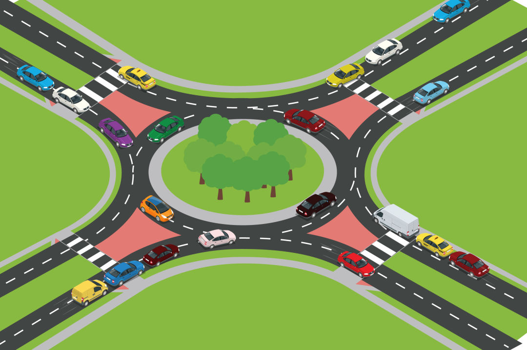
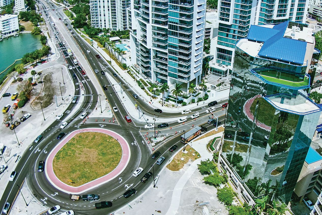
Jacaranda Boulevard and East Venice Avenue, Venice
Image: Rob Jones
Circle of Hell: Jacaranda Boulevard and East Venice Avenue, Venice
One of the oldest local roundabouts, this is also one of the worst, with a high crash rate that has encouraged drivers to avoid it altogether.
Why It’s a Problem: Designed as a futuristic three-lane roundabout at a time when many locals weren’t familiar with circular roadways, the intersection was built with wide swaths of pavement and asphalt curbs, as well as confusing signage.
Avoid It: This is tricky, particularly if, like a lot of folks, you’re trying to connect to I-75 at the Jacaranda on-ramp just to the north. Alternatives include heading east to North River Road to get on the interstate or cruising over to Laurel Road. Neither is ideal.
Fixed? Earlier this year, Sarasota County tweaked the roundabout design and signage. Builders changed the geometry of the roundabout lanes and approaching roads, added more visible pedestrian crossings and painted clearer lane stripes.
Verdict: It’s too soon to evaluate whether the fixes have reduced the crash rate, but planners are hopeful. With many roundabouts now in use here, drivers are more accustomed to the concept as well.
45% The number of drivers passing through the intersection declined by almost half after the installation of the roundabout
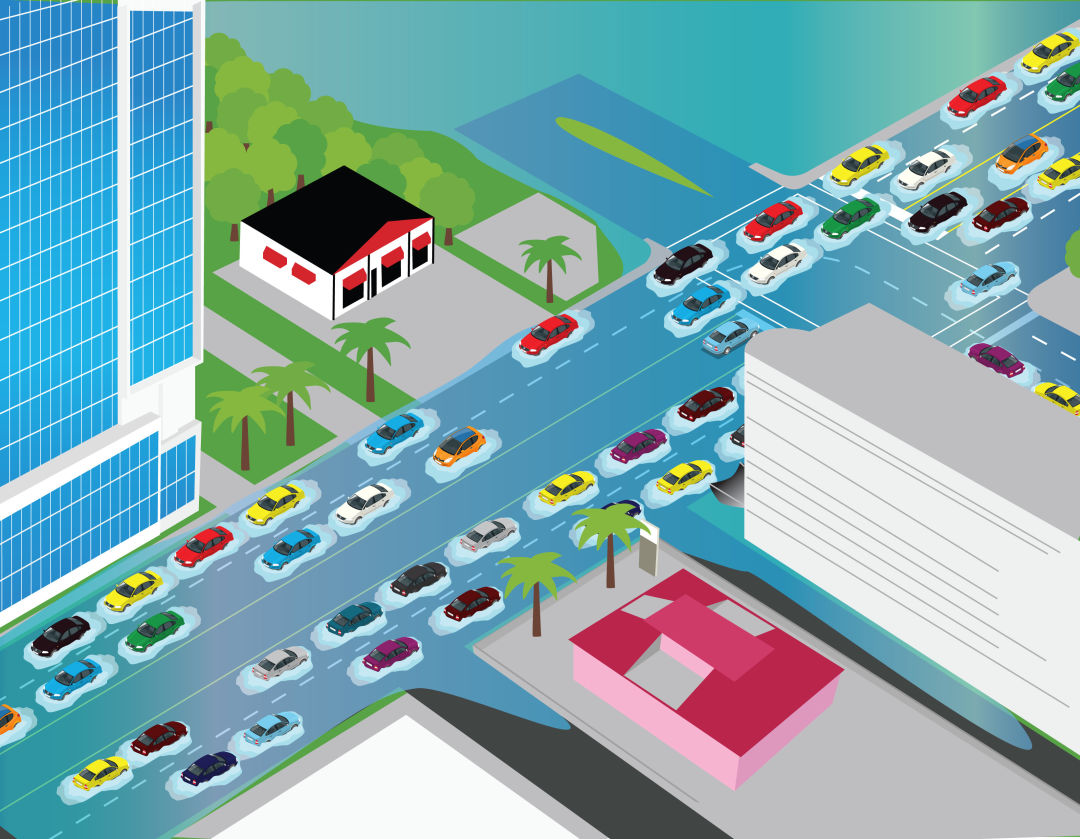
U.S. 41 and Fruitville Road, Sarasota
Image: Rob Jones
Natural Disaster: U.S. 41 and Fruitville Road, Sarasota
Every day, thousands of cars pass through on their way to and from downtown and the beach, slow-moving traffic that can come to a standstill when rainstorms flood U.S. 41 between Fruitville and Gulfstream Avenue.
Why It’s a Problem: Many drivers use Fruitville to connect from Lido Key to the interstate, generating long lines in the right-turn lane heading north on U.S. 41. Construction, low elevation and bad drainage don’t help.
Avoid It: If you are heading to I-75, try driving up U.S. 41 to University Parkway instead. You avoid downtown, as well as the tangle of traffic lights that makes heading east on Fruitville no fun.
Long Run: This area will see big changes, with major redevelopment plans for the former Quay property where Fruitville dead-ends into 41. Plans also include a roundabout and additional left-turn lanes coming off Gulfstream Avenue onto U.S.
41. Short-Term Fixes: The Florida Department of Transportation is making a few minor tweaks to the roadway right now, widening the angle of the right-hand turn lane that causes so many problems and putting pedestrian islands in the middle of U.S. 41.
141: The number of new condo units in the Vue, built at U.S. 41 and Gulfstream Avenue, in addition to the 255 new hotel rooms at the adjacent Westin hotel, which opened in August
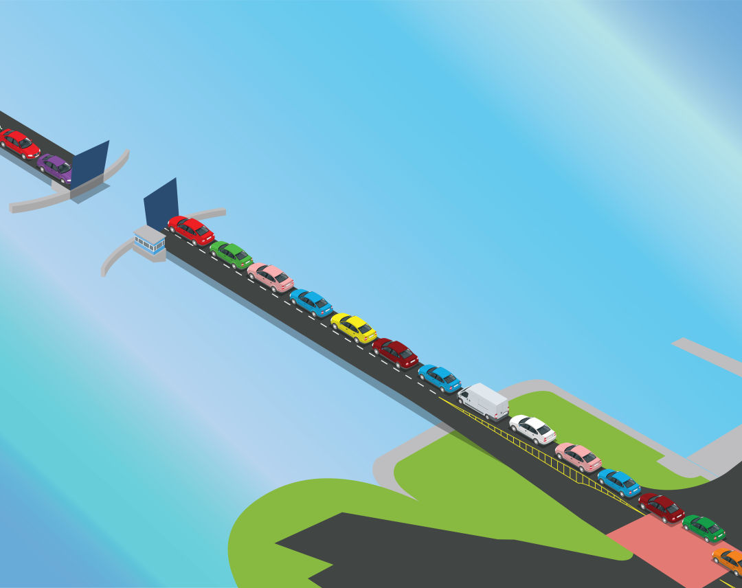
Cortez Road Bridge, Cortez
Image: Rob Jones
Drawbridge Drawback: Cortez Road Bridge, Cortez
Trying to get out to Anna Maria Island? Too bad. You’re trapped in traffic along Cortez Road, waiting for the cars ahead to dump onto the island, and you’re also forced to wait while the drawbridge goes up and down to let boats pass through.
Why It’s a Problem: The bridge was built in 1956 and was designed to last 50 years, a deadline that passed more than a decade ago. With just two lanes at a height of 17 feet, the bridge can’t handle the number of tourists and locals traveling to the island today.
Avoid It: There are only three ways on and off Anna Maria Island: here, the Manatee Avenue bridge to the north and from Longboat Key to the south. Especially on a holiday weekend, there aren’t great options. Dirigible, maybe?
Fixes? The Florida Department of Transportation is looking at three possible fixes: repairing and updating the existing bridge, building a new 35-foot-tall drawbridge or constructing a 65-foot-tall fixed bridge.
How They Might Help: The proposed 35-foot drawbridge would cut the number of times the bridge needs to open for boats by one-third, while the 65-foot bridge would eliminate drawbridge openings entirely.
Oh, and Another Thing: Traffic backs up so far along Cortez Road that it causes problems well to the east. The state is currently working on plans to rebuild the intersection at 119th Street West. That clogs up because the north-south roadways don’t directly connect.
2025: The year when the bridge might become unsafe if no repairs or replacements are made.