Elsa Barrels Down on the Southwest Coast of Florida
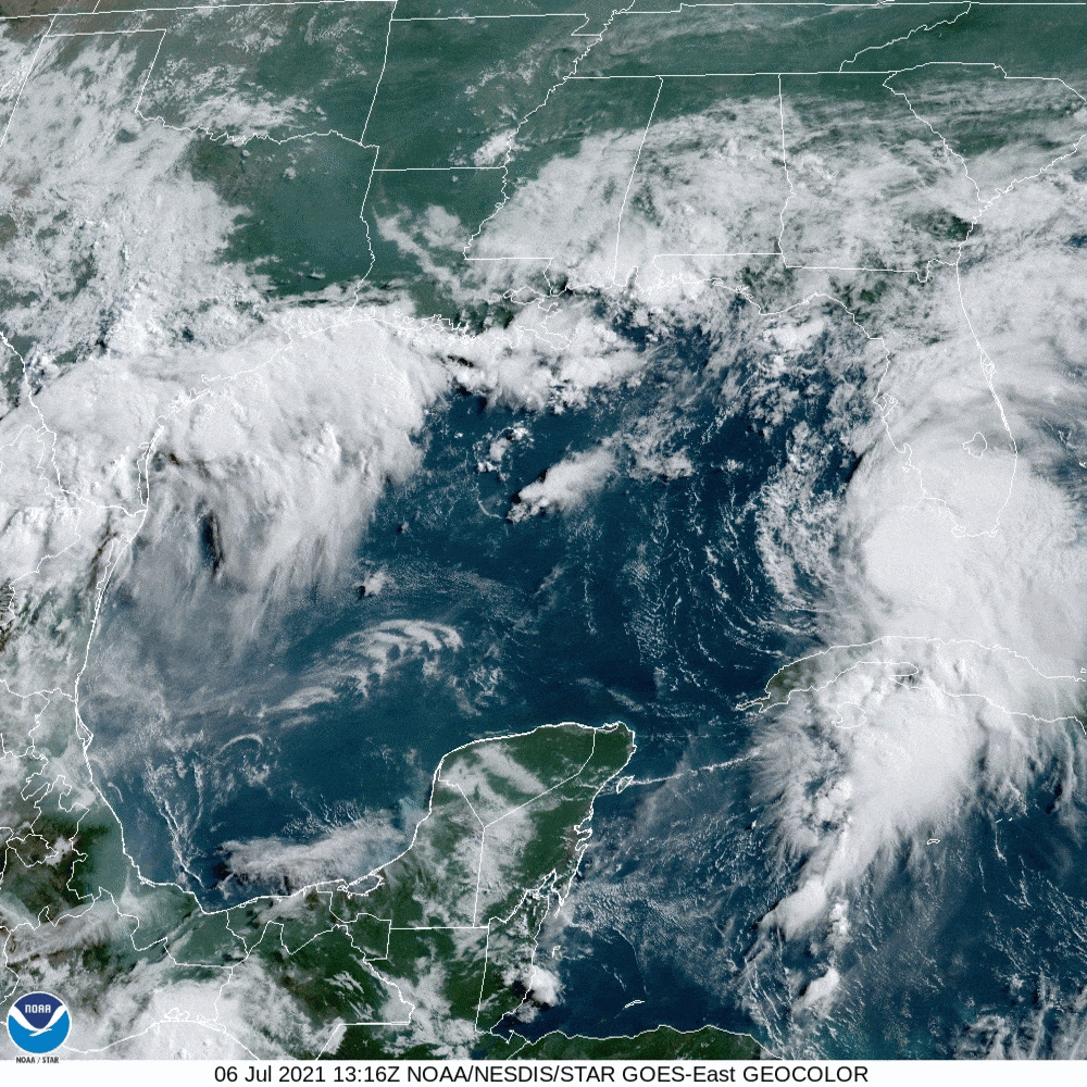
Tropical Storm Elsa on Tuesday morning, July 6
Image: NOAA
For the Sarasota region and most of Florida’s west coast, tropical storm, storm surge and flood warnings are in effect and a hurricane watch is in effect for Tampa Bay. Sarasota is very close to where hurricane conditions of sustained 74-mile-per-hour winds could develop tonight.
Elsa slowed down as it made the turn over Cuba and is now slowly moving northward, raking the Florida Keys and extreme Southwest Florida with gales, heavy rain and surging seas. At noon, its present location was about 130 miles south-southwest of Fort Myers.
The storm’s intensity briefly dropped but has now regained all that it lost and may be strengthening some right now. This is an impressive tropical storm, as I wrote yesterday.
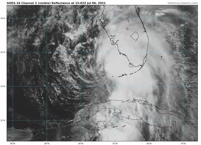
Tropical Storm Elsa on July 6, 2021
Image: NOAA
It continues to be impressive, as you can see on this visible NOAA satellite image taken at noon. Although upper air conditions in the Gulf are not ideal, the storm still could become a Category 1 hurricane as it moves northward over 83° F warm water along the entire west coast of Florida. Elsa is forecast to move inland in northern Florida about 100 miles or so north of Tampa tomorrow and then track up the east coast of the U.S. and even into Canada. (The CAC 2021 Hurricane Season Forecast predicted that tropical systems could reach this far north.)
While Elsa is not a hurricane, it is not a storm to take lightly. Local officials are making the call on what you should do as the storm approaches. Please listen and act as they try to protect you and others. Preparations should be wrapped up during the next few hours, as heavy rain and thunderstorms will move into Sarasota in about three to four hours and continue though tonight. Rainfall of three to five inches will soak the area, and flash flooding is possible. Tornadoes can accompany tropical storms, and there is a possibility of tornadoes during heavy thunderstorms. Check out the NOAA weather radar.
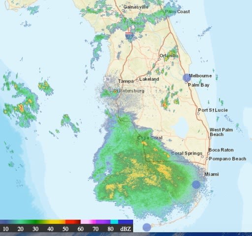
NOAA's weather radar on July 6, 2021
Image: NOAA
In Sarasota, southeast winds of 20 to 30 miles per hour should be noticeable about the time the rains pick up. Then look for steadily increasing winds all afternoon, with gale-force winds and tropical storm force winds of 39 miles per hour setting in around dinner time. The storm’s center will pass off the beaches just after midnight. By 10 p.m., the winds will begin gusting over 50 miles per hour and peak out at around 60 miles per hour around midnight, with a slow decrease after that.
The barrier islands from Siesta Key to Anna Maria will see higher winds for a longer period. Expect peak gusts around 65 miles per hour and perhaps 70 miles per hour in the northeast locations from 10 p.m. tonight until 2 a.m. Wednesday.
Storm surge will be an issue. The tide will be between high tide and low tide as the storm passes, but Elsa's close proximity to the coastline and strong winds will create storm surge conditions as the center of the storm moves north and then northeast late tonight and early tomorrow morning. A surge from one foot to three feet is possible. This is enough to cause beach erosion and sea flooding in low-lying areas and flood roads with deep water. This is a potentially dangerous situation.
While the rains will taper, they will continue through tomorrow, and the winds will subside to 20 to 30 miles per hour after sunrise tomorrow.
The heavy rainfall probably will be extensive enough and heavy enough to create high runoff into the Gulf. With red tide already present, this nutrient-rich runoff could set off a major red tide bloom in about two weeks.
Bob Bunting is the CEO of the Climate Adaptation Center. The CAC is here to help our community understand the impacts of the major climate warming we are experiencing right now. Hurricanes now have more ominous characteristics and red tides are becoming more widespread, longer lasting and more frequent. Please visit our website for all the information on climate warming and how it is impacting and will impact our area.


