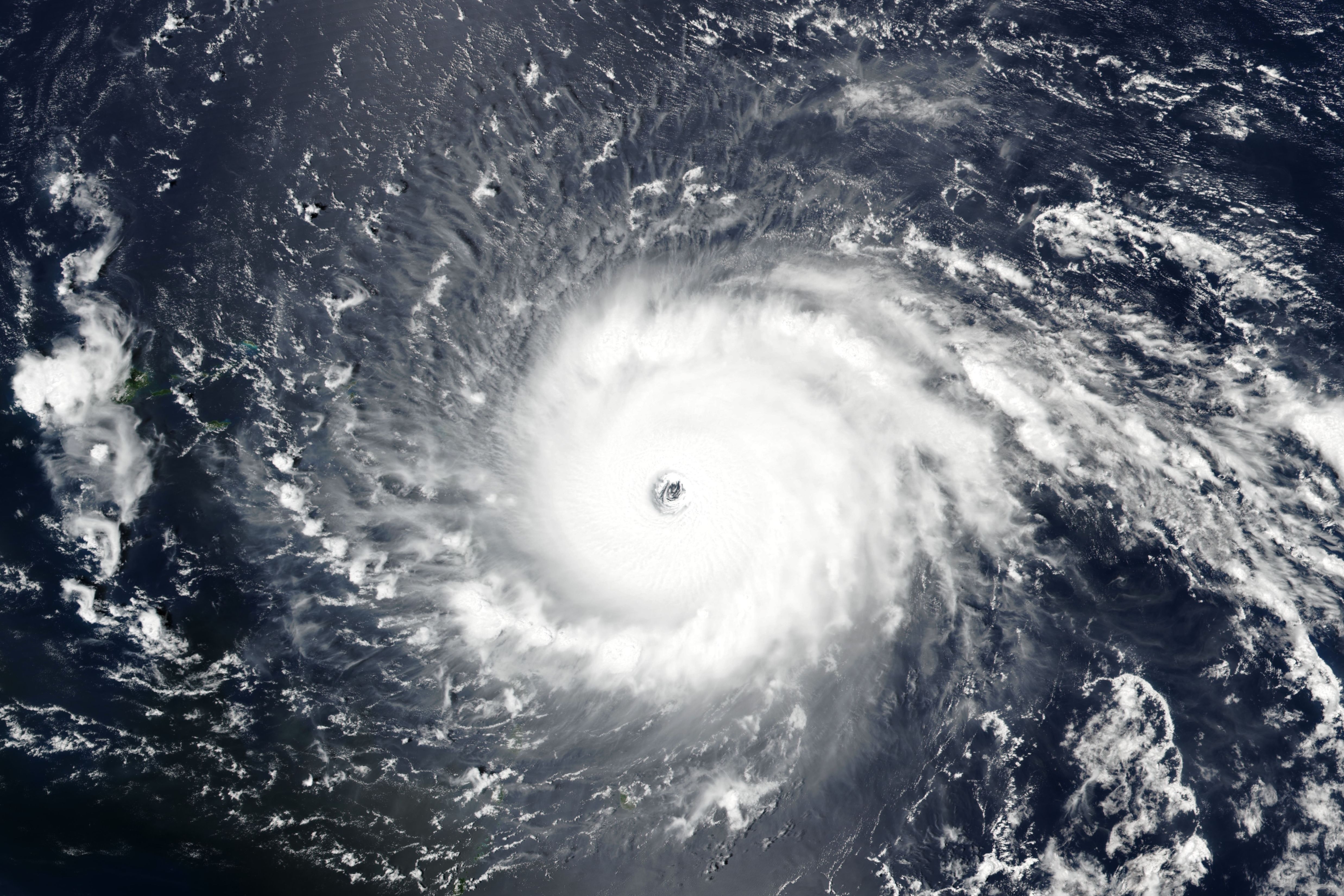
Hurricane Ida Eyes New Orleans and the Mid-Gulf Coast
Hurricane Ida on Friday, Aug. 27, 2021
Image: Courtesy Photo
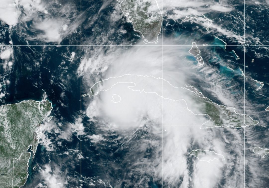
Hurricane Ida is strengthening as it approaches the western part of Cuba. It will move quickly northwestward and encounter the narrow, flat part of the island before emerging into a hot Gulf of Mexico. Because the water temperature is now well above normal, Ida will likely go through an explosive development cycle and strike Louisiana late Sunday as a major hurricane (Category 3 or higher)—the second major hurricane in the Gulf in the past two weeks. Hurricane Grace made landfall in Mexico as a Category 3.
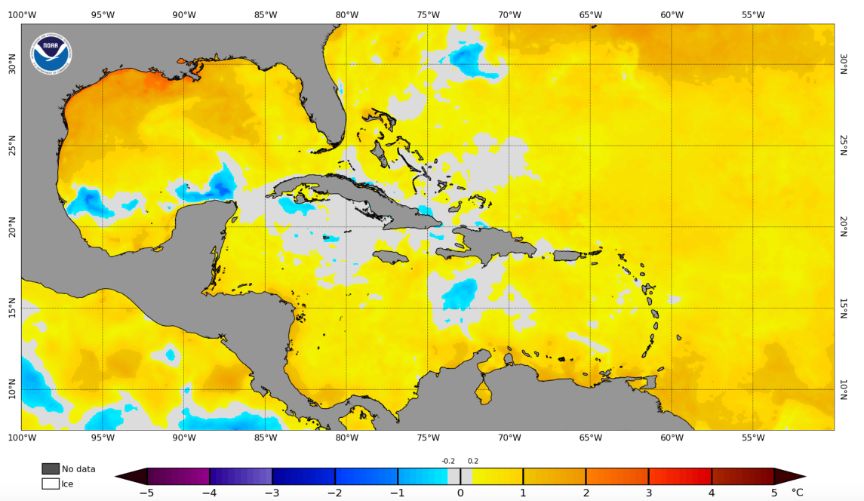
Sea surface temperatures show can extremely warm Gulf of Mexico—up to 8°F warmer than it should be this time of the year.
Image: Courtesy Photo
This sea surface temperature map from NOAA shows an extremely warm Gulf of Mexico, with water temperatures in the Gulf from 1°C to 4°C warmer than normal. In other words, the Gulf is up to 8°F warmer than it should be this time of the year. This is one reason the CAC forecast 20 tropical storms this season.
Warm water provides the energy hurricanes need to grow. The warmer the water, the faster they can intensify all other things being equal.
Now, look closely in the Gulf and notice the warm plume of water from just north of Cuba to the Louisiana coast. That's the loop current, which is about 90°F. In 2018, Hurricane Michael traveled over the loop current and exploded into a Category 5 storm in just 36 hours before making landfall at Mexico Beach, Florida, as the first recorded Category 5 to hit that area.
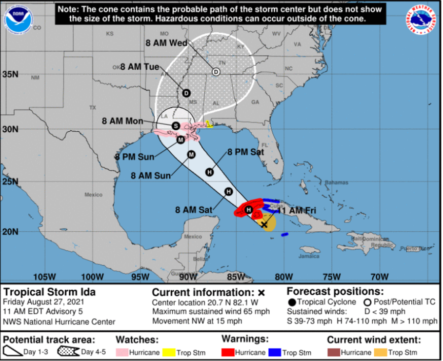
Ida's current track
Image: Courtesy Photo
The present forecast track for Ida, our eighth storm so far this season, is becoming quite certain. This morning’s cone indicates Ida will track right over the loop current.
As I write, the storm reached hurricane intensity earlier than forecast. A hurricane watch is in effect all along the Louisiana coastlines, with a major hurricane expected to make landfall Sunday evening.
Wind shear is minimal over this storm, meaning it can organize easily and attain a perfect alignment of its eye, making it vertical from the surface to the upper atmosphere, well above 40,000 feet. Such a structure is perfect to convert the sea surface heat to wind and rain.
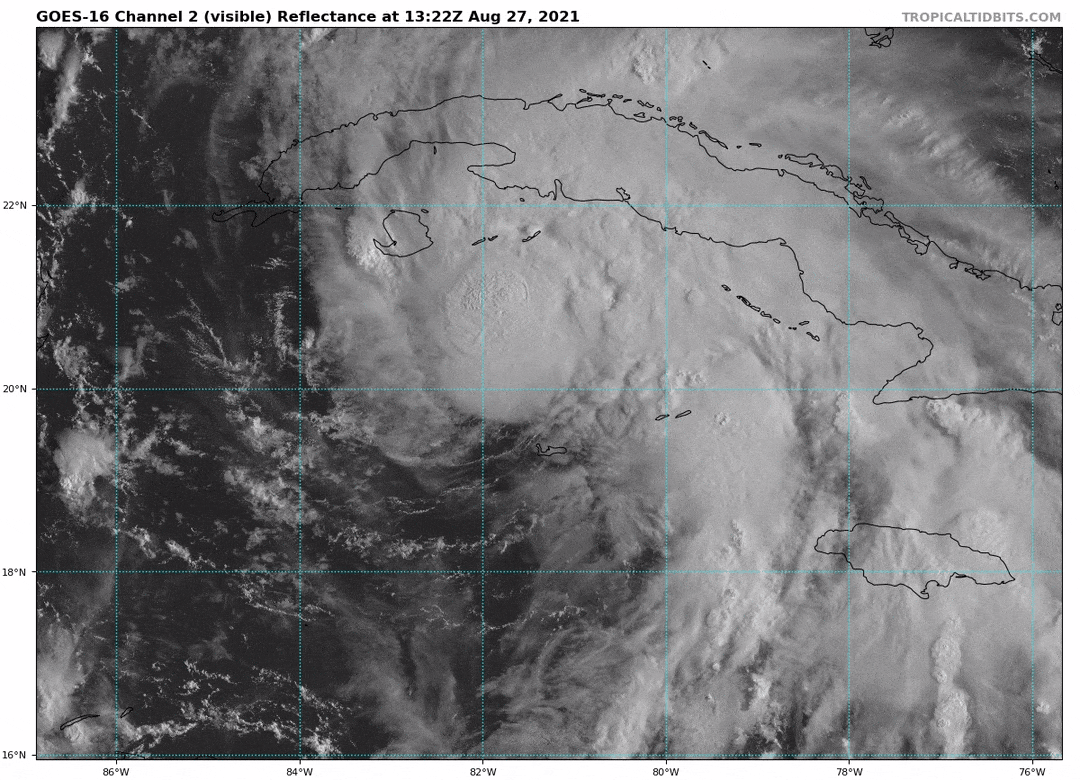
Satellite imagery of Ida moving into the Gulf of Mexico
Image: Courtesy Photo
The latest high-resolution satellite imagery from the GOES-16 NOAA Satellite shows the rapid organization of the storm with a massive cloud shield to the east and northeast of the center.
Ida will be a very strong, somewhat large storm that will impact a big area with high winds and flooding rains of up to 15 inches when it comes ashore in Louisiana.
With these near-ideal conditions, a Category 4 storm is not out of the question. Should the storm stay on its present course and go though an explosive development cycle— resulting in a stronger-than-now-predicted strength—catastrophic storm surge, flooding and winds could create dire conditions in the landfall area, including New Orleans. It’s still early, so conditions may change enough that landfall may be 125 miles or so different than now forecast.
Six tropical storms have hit Louisiana during the 2020 and 2021 hurricane seasons so far. Ida will be the seventh—not a lucky number!
Looking ahead, two other systems are likely to become tropical storms in the next few days and I believe there will be four new storms in the next few weeks. It’s another sign that climate warming is creating more extreme weather events more often—and of greater intensity.
Bob Bunting is CEO of The Climate Adaptation Center (CAC), the first such center to focus on the local impacts of global climate warming. On Nov. 19, at the University of South Florida Sarasota-Manatee, the CAC will host its second annual climate forcast: "Global to Local: The Climate Weather Forecast for 2030, 2040 and 2050, and the Reasons for Them." Tickets will be available on the CAC website in mid September.