The Ultimate Guide to Our Area's Sandbars
Dredging spoils, storm-shaped shoals and even a freshwater spring in the middle of the salty Gulf… our sandbars are a many-splendored bunch. As are the crowds they attract.
Whether you rent, buy or borrow a boat from a friend, you’re not immersed in our aqua culture until you meet up with strangers at a sandbar. If you don’t already know, sandbars are shallow spots in waterways that offer exceptional swimming, wading, floating, snorkeling, shelling, birding and more. But their true magic comes from the folks you encounter there and share those experiences with.
Eager to take a dip? This is our guide to some of our most popular local sandbars, including where to steer your vessel, what to expect when you get there and even places to refuel.
So pack some snacks, some drinks (including water, please) and loads of sunscreen, then shove off in search of sandy shores, laid-back crowds and spectacular sunsets. These sandy spots are not to be missed.

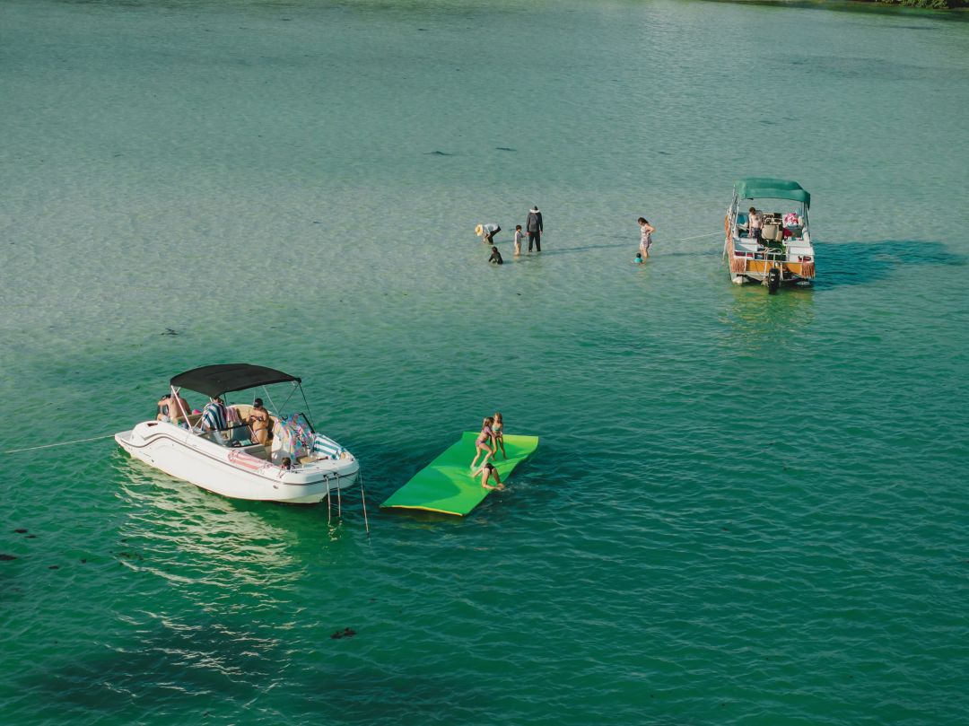
Image: Everett Dennison
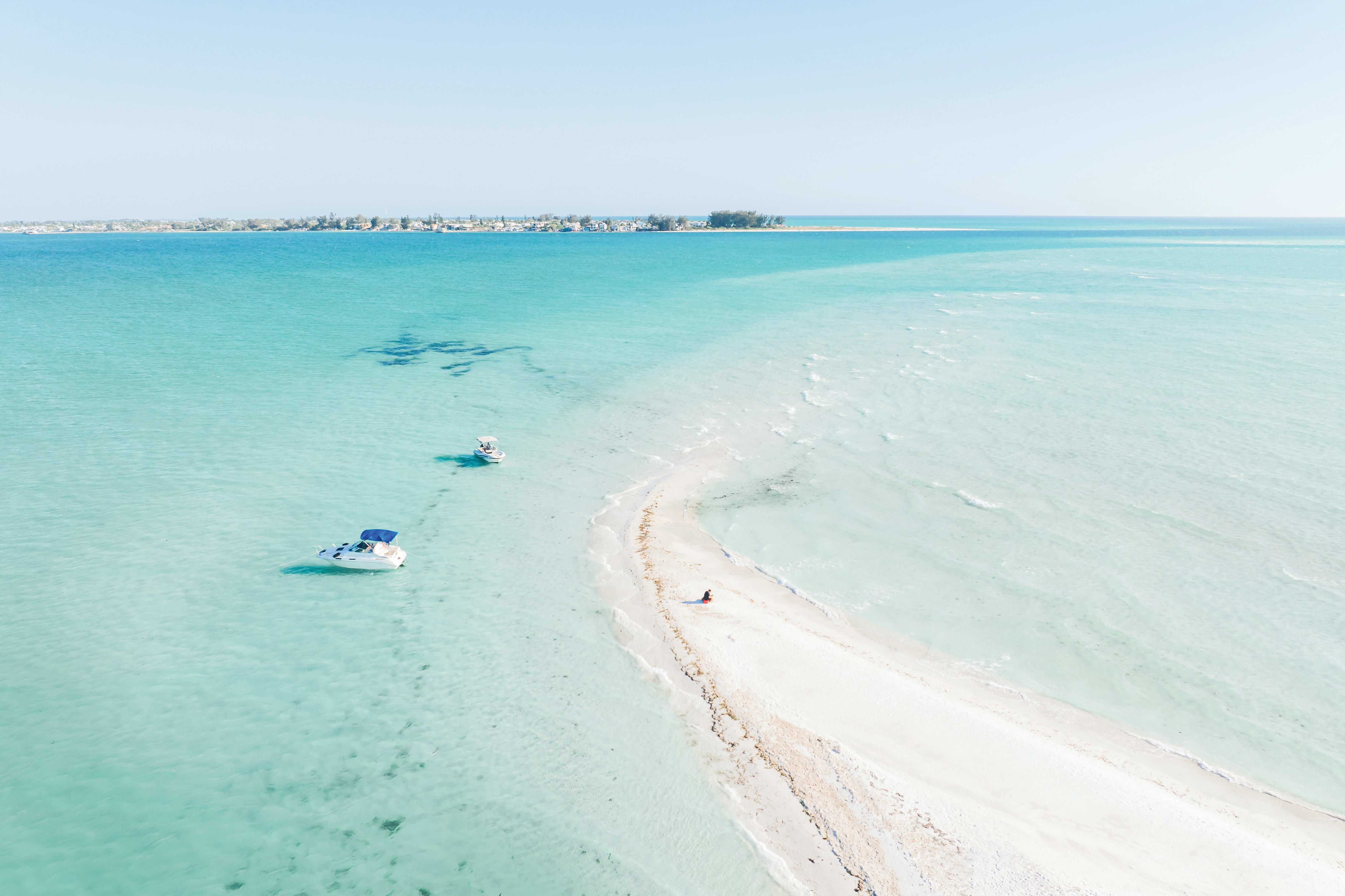
Jewfish Key Sandbar
27°26'35.3"N | 82°40'59.5"W
Look to the east as you drive over the drawbridge between Anna Maria Island and Longboat Key and you’ll know exactly where the party is. The shallow, white-sand stretch running parallel to Jewfish Key is like a glittering, fiberglass-dotted billboard for sandbar culture.
Longboat Pass, as the area is known, is one of the busiest and most accessible waterways in the area, providing Manatee County’s only Gulf access between Tampa Bay (7 miles north) and Sarasota’s New Pass (11 miles south). That makes the Jewfish Key sandbar prime real estate for kicking back in an inner tube and watching the world cruise by.
In peak season, dozens of boats anchor here. On holiday weekends, a hundred or more might appear, sometimes creating an almost solid boundary dividing the sandbar wading area from the deeper waters and powerful currents of the pass.
“It can be a really busy spot,” says Lucile Capo Miller of Cannons Marina, which has been renting out boats from its nearby Longboat Key headquarters since 1965. “Get there early,” she advises. “Some people like to pack their lunch, pack their drinks, pack some sunscreen. It’s great to take some tubes and just float around your boat.”
Image: Everett Dennison
But, Capo Miller warns, stay mindful of shifting tides and currents in the pass. “You definitely have to know if the tide is coming in or going out,” she says. “What’s really important is to stay on the sandbar and not swim in the pass. Even if it looks serene, it could be running.”
Given the size of the sandbar and the many anchored boats around its boundary, staying in the safe spots shouldn’t be too hard. All that’s left is to hop on your tube and make some new friends.
Where to Dock and Dine
Mar Vista Dockside Restaurant, a longtime standout for its romantic Old Florida setting and elevated fish camp food, was joined in 2019 by the nearby Shore and its modern seafood menu and craft cocktails. You can find both just across the pass on Longboat Key’s eastern edge.
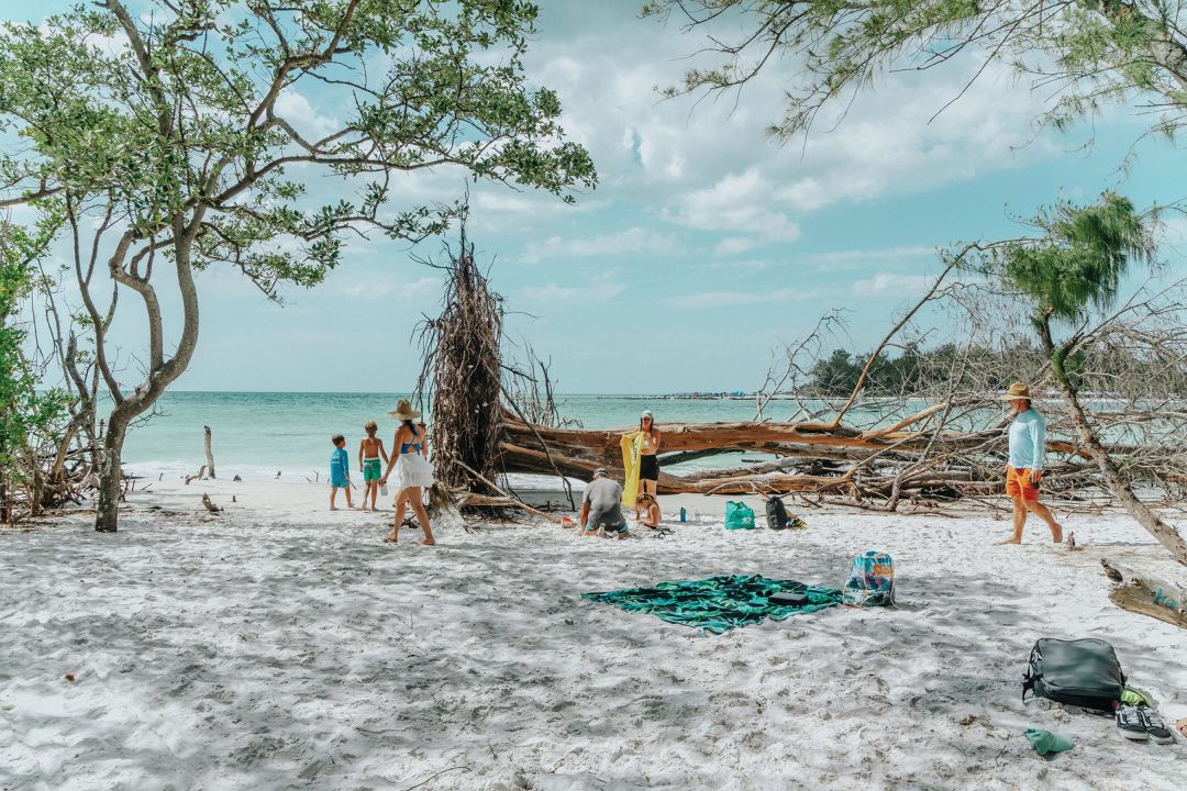
Image: Everett Dennison
Beer Can Island
27°26'29.5"N 82°41'19.5"W
Opposite Jewfish Key near the southwest base of the Longboat Pass bridge, Beer Can Island takes up the northern horn of Longboat Key. Despite its boozy name, this curve of unclaimed beachfront is typically the quieter of the two Longboat Pass destinations. (It’s also not an island, though it’s most easily accessible by boat.)
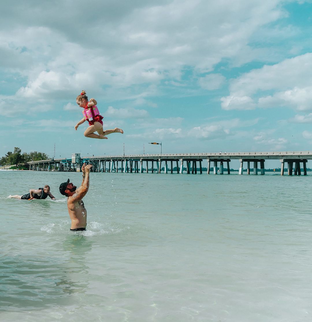
Image: Everett Dennison
Beer Can’s most prominent feature is its idyllic beach of felled, weathered Australian pine trees. Those windswept wooden ruins make for fantastic photoshoots, suggesting a remote tropical shore—though they lie just a stone’s throw from some of the most expensive real estate in the area.
Behind that arching beachfront is a hidden cove, open only on the eastern side and divided from the beach by a thick copse of still-standing pines. Altogether, Beer Can’s rich concentration of habitats makes it a must-stop spot for birders and photographers alike.
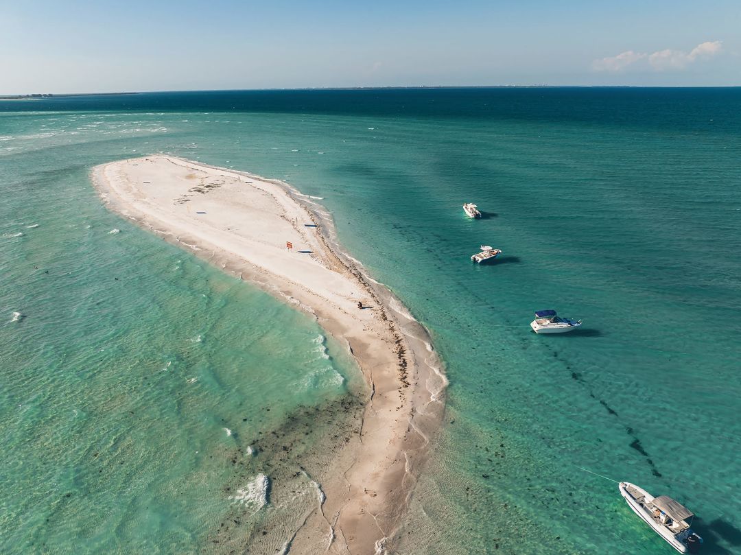
Image: Everett Dennison
Passage Key
Passage Key is the closest we have to a desert island. The northern Manatee County outpost marks the entrance to Tampa Bay and is located more than a mile from land in any direction. That makes it an isolated oasis with a checkered past, a place where the water is crystal clear and the laws are a little murky. This is the Wild West of West Florida.
Formed by a freshwater spring pushing up through the Gulf, Passage Key was once a mangrove island of 60 acres or more. Since at least the 16th century, the landmass has appeared in various records, changed hands several times and gone by a handful of names, until the Spanish finally dubbed it Cayo Del Pasaje in 1783.
Native seabird colonies have long thrived around the ready source of fresh water, and in 1905, Teddy Roosevelt designated Passage Key a National Wildlife Refuge. Then, during World War II, military pilots training out of the Sarasota Army Airfield set up targets on the island and practiced machine-gunning and bombing them.
Nowadays, after countless storms and ever-shifting currents, Passage Key hardly exists at high tide. Instead, crowds are drawn to a sprawling expanse of waist-deep, gin-clear water over white quartz sand that stretches as far as you can wade—the perfect conditions for snorkeling, socializing or just floating on a pool noodle in 360 degrees of paradise.
Despite its dwindling nature, the island’s protected status still stands. Posted signs declare that the beaches, when they emerge, are closed to all human visitors. Even when Passage Key is dry, your feet must stay wet in the wave-wash at all times in order for you to technically avoid trespassing. And don’t even think about bringing your pets.
“If you want to get people mad around here,” says captain Bruce Adamo of Passage Key Dolphin Tours, “just tell them you saw a dog on Passage Key.”
Image: Everett Dennison
And animals aren’t even the sandbar’s prime source of controversy. Longtime locals know Passage Key as a “clothing-optional” area. The practice sometimes leads to awkward encounters and territorial disputes.
“On certain days, there can be large groups” of nudists, says Adamo. “Some of them are nice people, and some of them are buttheads because they think they own the island.”
There are rumors that a loophole in Passage Key’s status as a federal wildlife preserve—not a federal park—leaves it outside the jurisdiction of indecent exposure laws. But that’s simply not true, according to a spokesperson for the Manatee County Sheriff’s Office. The county’s nudity ordinance does, in fact, apply on Passage Key, and law enforcement officers typically try to gain compliance through education.
But, the spokesperson adds, “Deputies also investigate and make arrests for lewd and lascivious behavior. That won’t be tolerated.”
Just like in the Wild West, the law has the final word. But if you plan to visit, it’s best to assume that you will encounter some nude outlaws roaming the wilds of Passage Key. Just something to bear in mind.
Where to Dock and Dine
The Rod & Reel Pier, an Anna Maria destination since 1947, sits 1.2 miles southeast of Passage Key. Or you can venture farther south to the historic Cortez fishing village on the mainland, where you’ll find Star Fish Co. and Tide Tables Restaurant and Marina, true dockside legends.
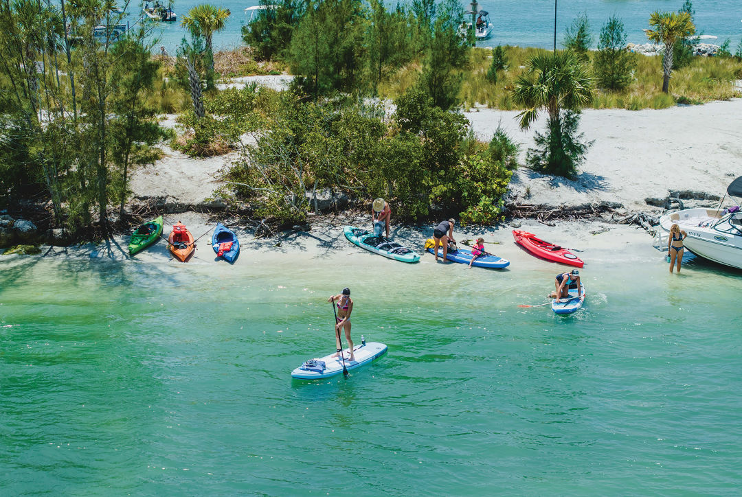
Image: Everett Dennison
Sharker's Island
27°18'31.4"N 82°33'40.7"W
Sarasota Bay’s brackish waters don’t have the same emerald-green appeal of the Gulf of Mexico. But what bayside sandbars like Sharker’s Island lack in glamour, they more than make up for in exceptional wildlife diversity—including shells that you won’t find anywhere else, not even around the corner on Lido Beach.
Sharker’s Island sits due east from the famed mangrove tunnels of Ted Sperling Park on South Lido Key. The “island” is little more than a shallow, sandy rise amid the grass flats that surround it. But in an area that draws hundreds of kayakers a month, this sandbar is a worthy destination for exploring an even wider assortment of marine species.
“You’d be surprised at the different kinds of sea life [in Sarasota Bay],” says Sally Peppitoni, president of the Sarasota Shell Club. “Not only are there mollusks like clams and conchs and whelks, there are oyster beds, sand flats and grass flats—mostly turtle grass and manatee grass—that support all sorts of wildlife: sponges, sea anemones, sea stars, sea urchins, seahorses. We’ve also found sea hares and sea cucumbers. And that can be in just a few inches of water.”
When it comes to shelling, beaches aren’t always best. Peppitoni, who’s been collecting shells since she was 3 or 4 years old, recommends walking into any nearby beach-trinket shop to purchase a laminated card displaying local shell species. And while you might get lucky and stumble onto something truly rare, Peppitoni gets most excited about a common shell that exhibits a surprising colorful anomaly only in Sarasota Bay.
“One of my favorite shells is the buttercup lucine,” she says. “It’s a bivalve; it has two halves like a scallop. It’s usually white on the outside, with a butter- or yellow-colored ring on the inside. But for some reason the buttercup lucines in Sarasota Bay are extremely flushed with bright orange. I’ve never seen that anywhere else.”
Where to Dock and Dine
Scoot around Bird Key and across the bay to hit downtown Sarasota’s Marina Jack and its tiki counterpart, O’Leary’s.
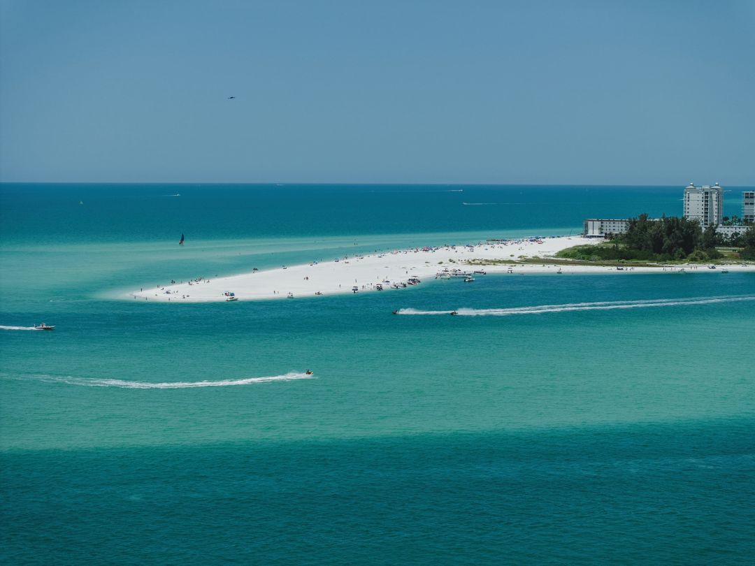
Image: Everett Dennison
Sand Dollar Island
27°17'31.5"N 82°33'45.6"W
Located near Big Pass, which divides Siesta and Lido Keys, Sand Dollar Island is the Gulf accompaniment to Sharker’s Island. This sandy rise boasts the same fine quartz sand Siesta’s public beach is famous for and draws swimmers, snorkelers and sea life enthusiasts, many in search of the island’s namesake sea urchin.
When most of us think of sand dollars, we’re actually thinking of the animal’s bleached skeleton. When alive, these bottom-dwelling discs are dark green or reddish brown, with a layer of hairs on one side that help them to crawl, burrow and move food into their centrally located mouths.
Unfortunately, some amateur “collectors” think that they can harvest the live species and find ways to bleach them later.
“You don’t want to get them when they’re alive,” says Peppitoni. “I’ve seen people load a bucket full of live sand dollars. Then they start to stink. They don’t want to put them in their car or their suitcase, so usually they just toss them in the garbage.”
In fact, even the act of pulling a live sand dollar up off the seafloor can damage it so much that it kills it. And while Sarasota has no regulations for live shelling, laws differ by county. In Manatee, for instance, it’s illegal to harvest more than two of the same live species per day (never mind by the bucketful).
“The best thing to do is if they’re furry and alive, just don’t mess with them,” says Peppitoni. Besides, Sand Dollar Island and its sunsets are too perfect to steal from.
Go Deeper
Want to know more about Sarasota Bay marine biology? A pair of standout boat tours focus on our spectacular marine habitats and the creatures that inhabit them. The Sarasota Bay Explorers, for example, partner with Mote Marine Laboratory & Aquarium for Sea Life Encounter Eco Tours. The Carefree Learner, meanwhile, has been educating local students for 45 years aboard its unique, 41-foot-long wooden boat. It offers community eco tours in partnership with the American Littoral Society.

Image: Everett Dennison
Snake Island
27°06'47.4"N 82°27'48.0"W
Located right where the Venice Jetty meets the Intracoastal Waterway, Snake Island has been a popular all-day barbecue spot for generations.
“We used to camp out there in our boats, spend the weekend shrimping and fishing,” says Sarasota native Jodi Alexander, who remembers what Venice was like well before I-75 started bringing crowds in the early 1980s. “I used to bring my black Lab to Snake Island for the day, and we’d go through a dozen tennis balls.”
It’s a unique location, tidally speaking. Clear Gulf waters surround the inland sandbar during incoming tides. But when the tide shifts, the ebb brings the brown, brackish waters of the Intracoastal into the area. And like a lone sentry, this mighty stalwart has long provided vital protection for inland areas from the Gulf waves and storm surges that can barrel through the jetty.
Those eroding forces have taken their toll. From 1977 to 2013, Snake Island lost approximately 80 percent of its surface area. A subsequent restoration project installed rock barriers and a western breakwater wall to slow erosion, and periodic sand replenishments have happened since then.
Still, the sandbar is losing ground. But old-timers and newbies alike continue to gather here. “There’s always friendly dogs,” said Alexander. “We had more land back then, and a lot of trees—so thick you couldn’t see through them. But there’s still tons of people who go there.”

Image: Everett Dennison
Now anchored by patches of grass and shrubs, the island’s eastern shore has just enough room left for a dozen or so vessels. On any given weekend, pontoons, deck boats, skiffs, cabin cruisers of all sizes and even rental boats anchor together rail-to-rail, with kayakers and SUP-ers paddling around the edges. Of course, it’s not unheard of (nor is it recommended) for more courageous partiers to swim over from the mainland to join their pals. (A safer option is just to wait for a lift; captains can easily ferry boat-less folks between the shores.)
Nowadays, Alexander takes her grandkids to the island, along with “a much smaller dog” than her old black Lab. And though she regrets the way some of the sands have shifted, she still enjoys the Snake Island crowds. “I’ve never been there and not gotten along with everybody,” she says.
Where to Dock and Dine
The Crow’s Nest Tavern and Marina, a Venice mainstay and neighborhood hangout in its own right, sits just over the channel to the south.